


Uzbekistan. Nature, Geography, Flora, and Fauna
Uzbekistan is a Central Asian country located on the largest of the six continents of the planet, framed by the Syr Darya and Amu Darya Rivers, the waters of which nourish the fertile land. The total area of the country is 448,900 km², 95% of which is land, ranking 56th in the world. The water area with undrained reservoirs accounts for 10%. The country is landlocked and, like Liechtenstein, neighbors countries that are also landlocked.
Kyzylkum Desert
The lack of ocean and sea moisture created deserts and steppes, which together with the mountains, occupy two-thirds of the territory. The sandy and rocky Kyzylkum desert with relief takyrs also crosses the borders of Turkmenistan and Kazakhstan, ending in the northwest with the Aral Sea. Its area is estimated at 300 thousand km². There are mountains composed of Paleozoic shale. It is noteworthy that the scarlet dunes of Kyzylkum hide rich reserves of fresh water in their depths. Muruntau gold mine was discovered in the desert of the Zarafshan suburb of the Navoi Region, and the uranium ore pit was discovered near the town of Uchkuduk. The most extreme temperatures are registered here in summer and winter, and in spring, during the blooming of wild tulips, one can admire incredibly spectacular views. Fine-toed gophers, gerbils, marmots, barking cats, fox-corsac, tufted larks, desert warblers, as well as gurza and aefa snakes live here.
"The Hungry Steppe" of Mirzachul
The clay and salt Mirzachul Desert, also called "The Hungry Steppe," is located on the left bank of the Syr Darya River, on the edge of the Fergana Valley, and stretches across the borders of Tajikistan and Kazakhstan. From the south, it is bounded by the foothills of the Turkestan ridge. The approximate area is 10 thousand km². The most common plants here are sedge and camel's thorns.
Mountains of Uzbekistan
The Tien Shan and western Pamir-Alai mountain systems, located in the east and southeast of Uzbekistan, also pass through the territory of four other countries which are Tajikistan, Kyrgyzstan, China, and Kazakhstan. At their feet, there are subtropical high grass steppes and woody and shrub vegetation. Alpine low-grass meadows can also be found, which are often used as pastures. There are even forests of wild apple and apricot trees and fir species surrounded by mountains in the Fergana Region. The highest point reaches a peak at an altitude of 4,643 m. The mountains are rich in deposits of oil (in the basins), mercury, silver, antimony, zinc, lead, and cadmium. The area is inhabited by brown bears, wolves, mountain goats, apers, tolai hares, marmots, ferrets, jerboas, mole lemmings, goitered gazelles, lynxes, lizards, snakes such as the Dione snake and the copperhead snake. Among the feathered birds, there are pika, horned larks, alpine choughs, finches, and wheatears. Freshwater fish are chebak, osman, and marinka.
The plains (the Kyzylkum desert, the Ustyurt plateau, and the Amu Darya delta), located in the northwest and south-west, are interspersed with highland reliefs.
The northernmost point is on the west coast of the Aral Sea, peaking at the Ustyurt Plateau. The southernmost point is the town of Termez, Surkhandarya Region, at the border with Afghanistan. The western point is the state border with Kazakhstan along the Ustyurt plateau. The eastern point is the border area with Kyrgyzstan, in the Fergana Valley, north of the Andijan reservoir.
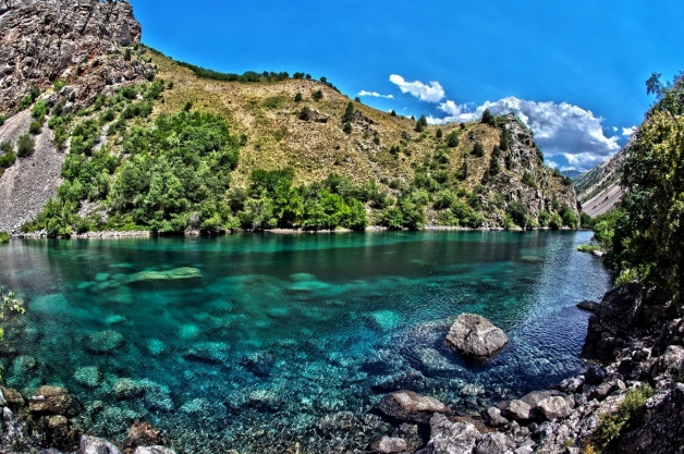
Lakes of Uzbekistan
A popular attraction in the north-south is the freshwater, drainless Lake Aydar (Aydarkul) with an area of 3,000 km². It is an artificially created reservoir based on the Syr Darya dam and is part of the Aidar-Arnasai system of lakes, part of which is also slightly less well-known among tourists of Lake Tuzkan. The northern boundary reaches the dried-up southern shores of the Aral Sea and is the second in importance and scale of water reservoir after the Aral Sea itself. Fish species such as catfish, snakehead, bream, sickle fish, carp, and pike-perch were introduced to develop the fishery.
Borders of Uzbekistan
The total length of the state borders is 6221 km. In the northeast, Uzbekistan borders with Kazakhstan (2203 km), with Turkmenistan in the west (1621 km), with Afghanistan in the south (137 km), with Tajikistan (1161 km) and Kyrgyzstan (1099 km) in the east and southeast accordingly.
Climate of Uzbekistan
The climate is sharply continental, with a high-temperature amplitude, dry, hot summers, and cold winters with high humidity levels and low precipitation in the plains. This climate is characteristic of Eurasia: Russia, Ukraine, Canada, USA, Mongolia, and Kazakhstan. The mountain zone is characterized by a special microclimate.
During the day there is a significant temperature change, especially in the interseasonal period with hot days and cold nights. Most days are sunny and cloudiness is low. Strong winds are frequent. In recent years, the dustiness of the air has increased, including dust storms in particularly arid areas. Masses formed by soil particles and desert sand grains are carried by the wind for considerable distances, reaching larger towns even if the speed does not exceed 10 meters per second.
The region is characterized by high seismicity, earthquakes with the destructive power of 8-9 points have repeatedly happened.
Towns in Uzbekistan
As of 2022, there are 120 towns in Uzbekistan, located in the valleys of the Syr Darya and Amu Darya rivers, where people's life is concentrated. The largest population is traditionally registered in the capital, Tashkent, with 2,393,000 people, which makes it the largest city in Central Asia in terms of this index. At the same time, the town is characterized by the lowest rate of population growth. Five more cities reach 250-500 thousand people: Namangan, Samarkand, Andijan, Nukus, and Bukhara. Samarkand is also the second largest city of Uzbekistan by area, and until 1930 it was the capital center of Uzbek statehood.
Exclaves of Uzbekistan
There are four exclaves in the republic, separated from the main territory: Shakhimardan, Jangail, Sokh, and Chon-Gara. All of them are in the Fergana Valley, surrounded by the territorial zone of Kyrgyzstan.
Also, the enclaves of Kyrgyzstan (Barak) in the Namangan area and Tajikistan (Sarvak) are on the territory of Uzbekistan.