


Rivers of Uzbekistan. Mountain rivers
In the countries of Central Asia, it is the mountains that can be considered as the predecessors of life. They provided a favorable microclimate protecting the land from strong winds. When melting, the snow and glacier formed about 600 drainage rivers with clear water suitable for drinking, farming, and fishing, thus covering the important survival factors for the ancient people. Over time, settlements were established along the major rivers.
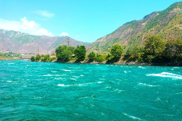
The Pamir, Gissaro-Alai, and Tien Shan mountains feed the tributaries of all rivers in Uzbekistan, including the largest ones of the Amu Darya and Syr Darya. They account for ¾ of the total volume of water coming down from the mountain massifs, through the arteries of small rivers, and cliffs. In spring and autumn, the rivers receive additional water supply from precipitation.
The Amu Darya River
The Amu Darya is one of the largest rivers in all of Central Asia. Its length is 2,600 km, and it extends from Tajikistan, through Afghanistan, Tajikistan, and Turkmenistan's Turkmenabat, Karakalpakstan, and Uzbekistan. The towns of Nukus, Termez, and Urgench are located on its banks. The Amu Darya also flows through Khorezm, Surkhandarya, and Bukhara Regions.
The Amu Darya was formed from the confluence of the Tajik Vakhsh and Panj Rivers, which originate in the Hindu Kush, Pamir, and Gissar-Alai Mountains. Changing the course of the river, which formerly flowed into the Aral Sea, was the main cause of the ecological disaster of drying up the Aral Sea.
The name of the river Amu Darya comes from the words "Amu" (a reference to the ancient city of Amul) and "daryo" meaning "river". Ancient Greeks called it "Oxus." and Zoroastrians - "Vakhsh", in honor of the goddess of fertility. Amy Darya has survived to the present day, though in respect of only one of its tributaries.
Navigation on the Amu Darya is practiced in the Turkmen part; in Tajikistan, the river is used to generate electricity; and in Uzbekistan to fish and irrigate fields.
Syr Darya River
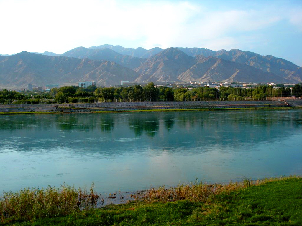
The Syr Darya is the longest river in Central Asia. it is formed by the Kyrgyz mountain rivers Karadarya and Naryn, flowing through the territory of Andijan, Fergana, Namangan, and Tashkent regions, as well as through the Syr Darya Region in Uzbekistan, and, bypassing the Aral Sea, flows into the Small Aral Sea, also reaching the territories of Tajikistan, Kyrgyzstan, and Kazakhstan. In Tashkent Region, it is fed by the Chirchik and Ahangaran rivers. The length is 2,790 km.
The local people connect the origin of the name of the river with the Turkic tribe "Shir, who used to live on its banks in ancient times. In the written sources of antiquity, it was called the Yaksart meaning the"Pearl River."
The streams of Syr Darya are meandering and characterized by a multiplicity of channels, the swampy delta contributes to the formation of small lakes, with tugai forests and reeds. Such branching facilitates the use of its waters for agricultural purposes for growing vegetables, fruits, rice, and cucurbits.
The Syr Darya River is the base for hydropower plants and the Kayrakkum and Chardara reservoirs. The Chardarya reservoir led to the formation of Aydarkul Lake in the Kyzylkum Desert. In 1969, as a result of heavy precipitation, the Syr Darya was overflowing. To avoid a dam breach, the water surplus was released into the desert Arnasai lowland. Over time, the water level continued to rise, forming the full-flowing, beautiful Aidar Lake as it now appears to the astonished tourists traveling along the barchans of red sands. The scale of its current water area allows Aydarkul to retain its status as the second-largest lake in Uzbekistan.
The Zeravshan River (Zarafshan)
The Zeravshan river, although inferior to the Syr Darya and Amu Darya in total length and length of water massifs, but throughout the history of the population living on its banks, it has played an important role in the life of the inhabitants. Its length is 781 km. It originates in the Zeravshan Mountains and flows through the territory of Tajikistan and Uzbekistan in equal proportions. It is a tributary of the Amu Darya River, fed by numerous mountain tributaries.
On the banks of the Zarafshan River, the towns of Penjikent in Tajikistan, and Navoi as well as the legendary Bukhara and Samarkand in Uzbekistan arose. The Zeravshan shoreline also possesses a unique monument of antiquity included in the UNESCO World Heritage List - the ruins of the ancient town of Sarazm. Archaeologists have also discovered the Zamanbobo settlement dating back to the Neolithic Age.
The name means "gold-bearing" in Persian. In the Chinese sources, it is mentioned as "Nami," in ancient Greek as "Politimet," which in both languages means "venerable, revered."
Numerous canals of the Zarafshan River are used to irrigate 560,000 hectares of land, 85% of its water volume, making it a key player in Uzbekistan's agricultural field. Its "golden waters" supply life-giving water to Bukhara, Samarkand, and Navoi Regions. In Tajikistan, it is planned to develop the Zarafshan River as a resource base for hydropower plants.
Akhangaran River
The Akhangaran River feeds the Tashkent and Namangan regions of Uzbekistan. Being the right tributary of the Syr Darya, it is formed by the waters of the Urtalyk and Aksai rivers in the mountain ranges of Kuramin and Chatkal, under the Boshrawat Pass. Its length is 236 km.
From April to June, it is at its fullest due to the melting of mountain glaciers and precipitation.
The Akhangaran River has two reservoirs called the Akhangaran and the Tuyabuguz more popularly known as the "Tashkent Sea" or "Tashmorel" It is located in Urtachirchik District and is a favorite place for outdoor recreation for residents of the capital, which is explained by its close location of only 32 km, that is just half an hour drive. In recent years, the Tashkent Sea began to rapidly acquire tourist infrastructure.
Akhangaran and Angren are the largest towns formed on the Akhangaran coast. Archaeological excavations have revealed that once there was the ancient town of Benakent.
The name comes from the Tajik village of the same name " Akhangaran" meaning "blacksmiths." It was believed that the most skilled masters of blacksmithing lived here.
Akhangaran's canals irrigate the fields of the entire Tashkent Region, including Bukinsk, Pskent, Urtachirchik, and Akhangaran districts. In 2020 the Kamchik mini hydropower plant was commissioned here.